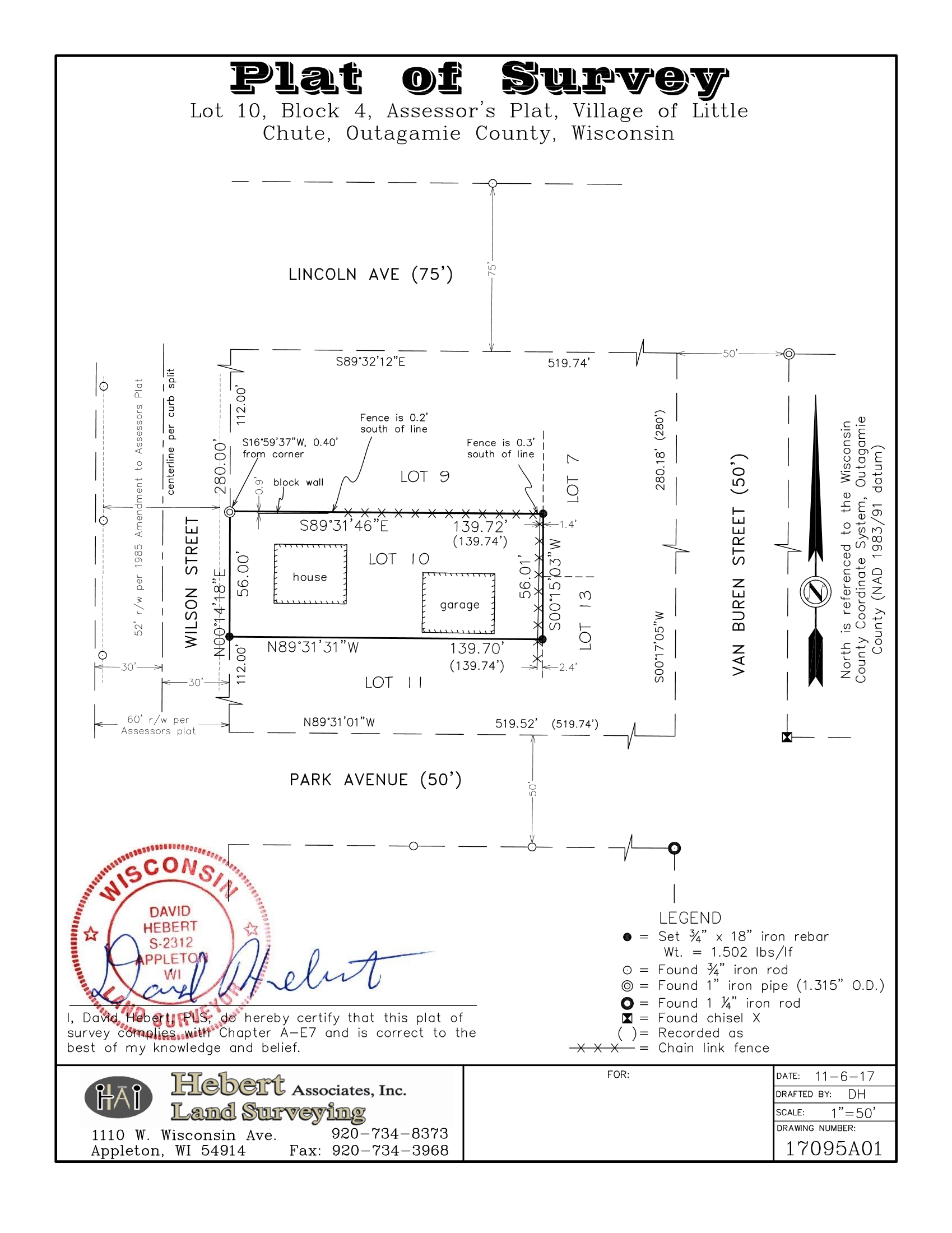
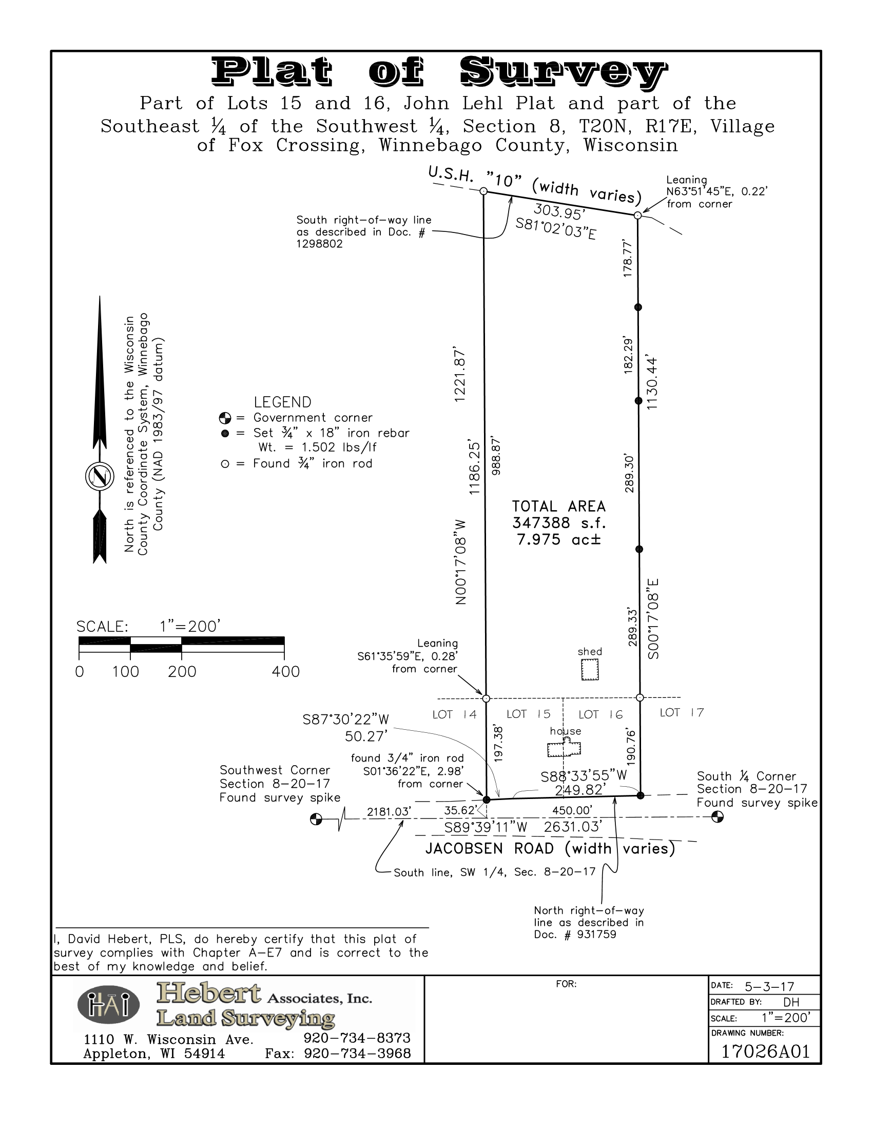
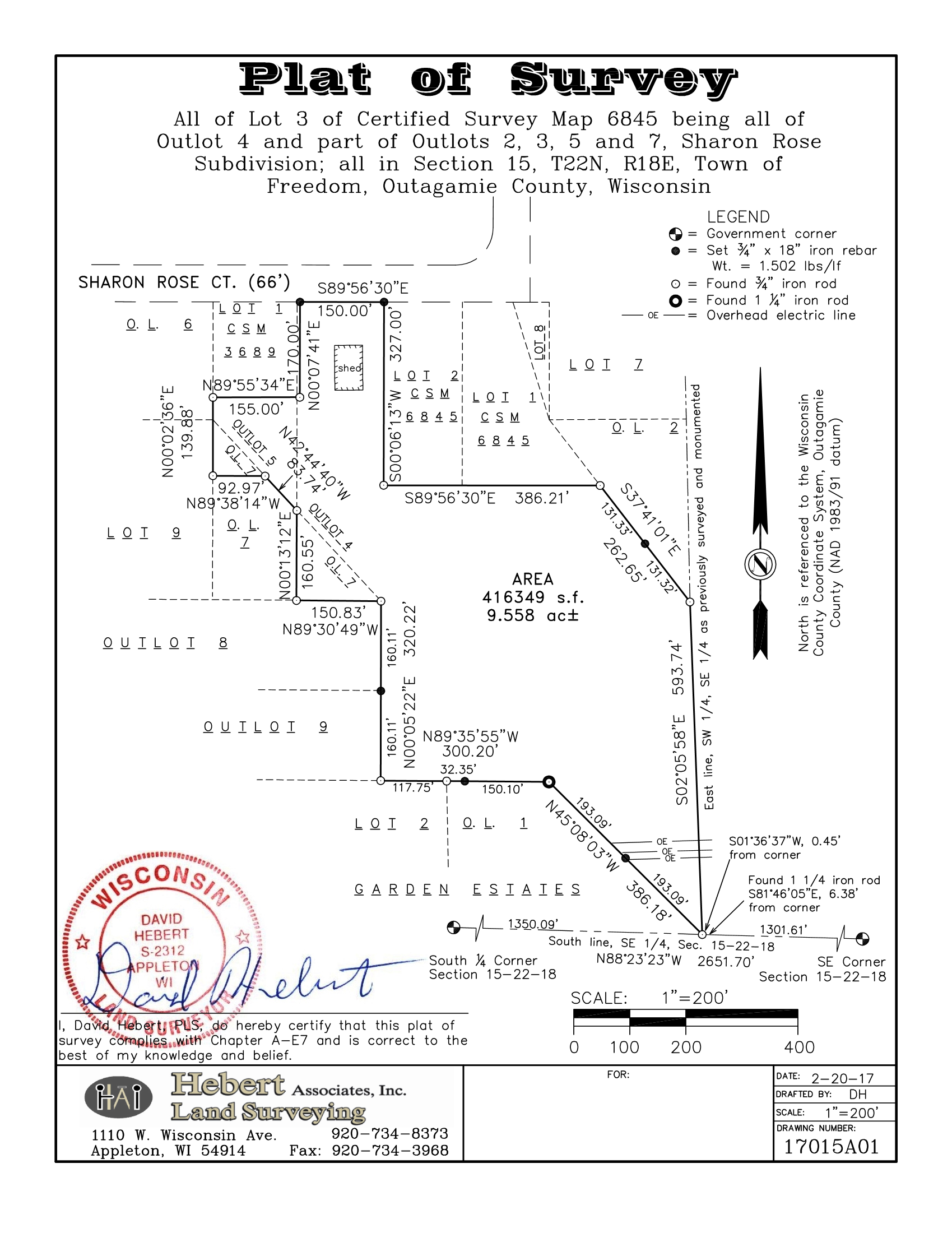
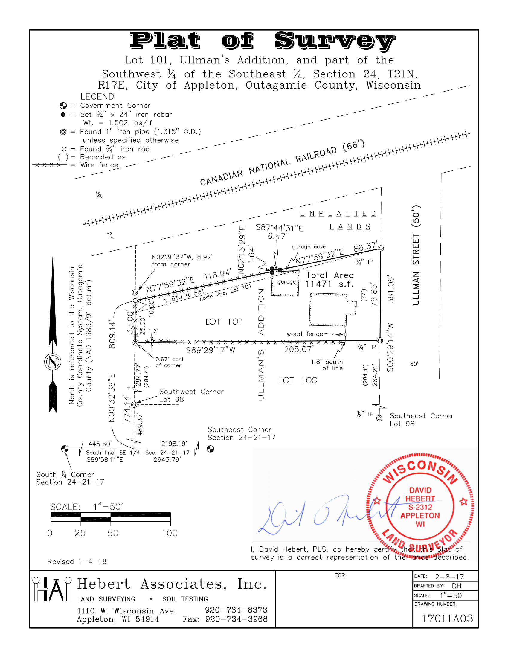
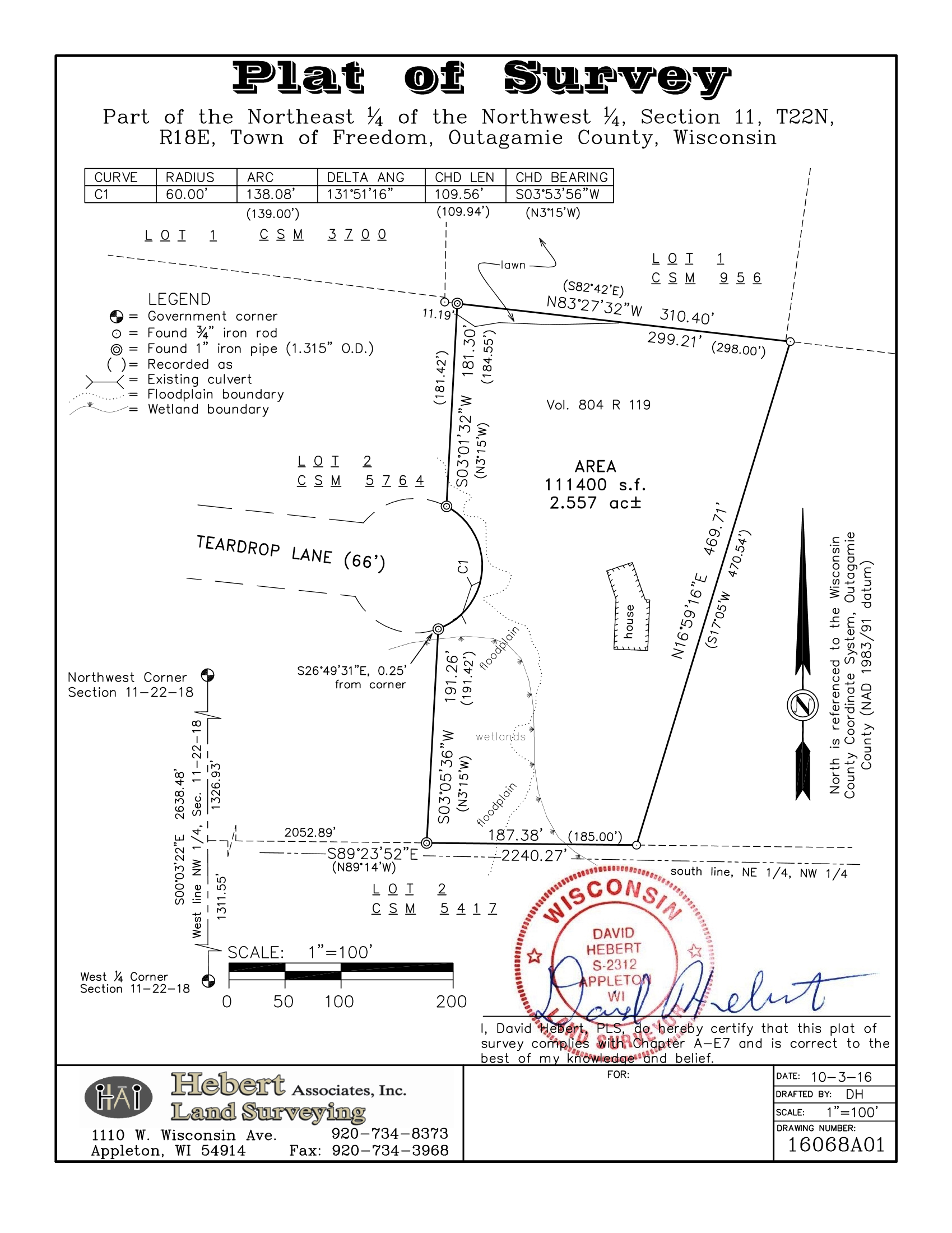
A survey that reestablishes the lot lines of an existing lot is referred to as a boundary survey or lot survey. Lot surveys are often required to help settle lot line disputes or to put up a fence, house addition, or various other structures.
A plat of survey is included with all lot surveys. The plat of survey contains much information. It shows the bearings (direction) or angles and distances around the lot, it shows any structures on the lot, it shows the location and type of all monuments (corner markers) found or set. It can also show if there are any problems such as encroachments by structures or objects that cross the lot line, or problems with title such as deed gaps and overlaps.
The plat of survey can also be useful if a surly neighbor decides to remove the corner markers, an all too common problem, or if they are inadvertently removed by construction activity. The plat of survey is evidence as to what was set at the lot corners and where it was set so that it can be easily reset and, if necessary, the plat of survey can be used to prove in a court of law that the corner marker was reset in the proper location.
Examples of lot or boundary surveys: